Boy - get your riding in on the National Forests soon - fire season looks to be nasty this year. I don't think it will take a fire at Tahoe to close trails early.
Lots of roadside spots along 80 from Roseville to Auburn in the last week, and info from YubaNet today:
Multiple vegetation fires burning in California as a result of yesterday's northern wind event.
Ophir near Oroville, 1,600 acres 60% contained.
Jackson, Sac. Metro 4,200 acres 40% contained.
Indians, Los Padres National Forest 4,200 acres 10% contained.
La Grange, Tuolomne County,, 1,200 acres 90% contained.
Pine, Sonoma County, 860 acres, 80% contained.
41 Fire, 10 miles north of Fresno, 3,300 acres 100% contained.
Full updates: http://yubanet.com/fire.php
Fires
Moderator: hemingray
-
hellcat650
- Knows UPS driver on a 1st name basis
- Posts: 388
- Joined: Thu Oct 25, 2007 2:48 pm
- Location: reno nv
Yep, it's definitely scary. A few years ago a boat trailer lost a wheel and the sparks caught the hillside above the road - a house got it within minutes and we had to evacuate for awhile. Fortunately nothing more, but it was sad that the guy lost his house even though he was in compliance with the defensible space requirement at the time (now it's 100 feet).
There was a fire at Newcastle off 80 on Sunday....interestingly, rode on Saturday in Tahoe, and no dust...and still a fair amount of snow. Much more than last year.
Tahoe did fire restrictions on fires on June 8 last year.
Tahoe did fire restrictions on fires on June 8 last year.
The last words spoken before a YouTube video is filmed: "Hold my beer, now watch this..."
Regards,
Ken Hower
RTF Director
http://www.rubicontrail.org/
Regards,
Ken Hower
RTF Director
http://www.rubicontrail.org/
rookie question.
so when you say get your riding in while you can does that mean they will close the trails for ohv use??? or does it just mean no campfires?
thanks
so when you say get your riding in while you can does that mean they will close the trails for ohv use??? or does it just mean no campfires?
thanks
Angelo
My Business mention ATV Obsession and i will hook you up.
http://www.mygemologist.com
K0HMR
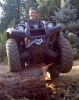
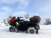
My ATV!!
2006 Kodiak 450
warn 2500 winch, heated hand grips, and full custom skid plates with wrap around steel fender guards :) and 25" Bighorn tires
My Business mention ATV Obsession and i will hook you up.
http://www.mygemologist.com
K0HMR
My ATV!!
2006 Kodiak 450
warn 2500 winch, heated hand grips, and full custom skid plates with wrap around steel fender guards :) and 25" Bighorn tires
It starts out with the campfire restrictions but after the fire near Tahoe last year, they (Tahoe NF) closed some popular ATV areas and "trails". There was quite a bit of confusion over just what was closed and even the Forest Service contradicted itself over the exact closures. It was kinda dumb that you could start riding in the Plumas and when you came to the Tahoe NF border you could not continue on the trail legally.
See this thread: http://atvobsession.com/board/viewtopic.php?t=1597
My personal opnion is that once a precedent is set - closing the access because of perceived fire danger - it will be easier next time. Anyway, Fordyce was closed along with Bear Valley OHV and I think the Foresthill system ended up being closed too.
On the other hand, there's a new sheriff in town - the Tahoe Forest Supervisor is different this year. We shall see!
Dave
The ONLY Saving grace about TNF this year....Tom Quinn is now the Forest Supervisor. He said in our meeting, he thought it was a knee jerk...and commented that his forest was just as dry and he didn't place a fire restriction on Stanislaus.
We pointed out the fire near Tahoe was started by an illegal fire started by a backpacker...not a car, truck or OHV...and he acknowledged that.
I would be surprised if he did it this summer too. Essentially, the only thing of significance that it closed was the Fordyce...since all the USFS roads were open.
The last words spoken before a YouTube video is filmed: "Hold my beer, now watch this..."
Regards,
Ken Hower
RTF Director
http://www.rubicontrail.org/
Regards,
Ken Hower
RTF Director
http://www.rubicontrail.org/
-
Norcalbmxer
- Is tracking a shipment right now
- Posts: 135
- Joined: Thu Apr 17, 2008 9:24 am
Re: Fires
heres some other good sites for fire infohemingray wrote:
Full updates: http://yubanet.com/fire.php
http://activefiremaps.fs.fed.us/
http://www.firedetect.noaa.gov/viewer.htm
http://cdfdata.fire.ca.gov/incidents/incidents_current
and for mapping the fire location
http://wildfire.cr.usgs.gov/calfireplan/viewer.htm
Hopefully rational thinking will prevail! Sounds like a good guy to have on the Tahoe now.
Local fire info for our area: http://yubanet.com/fire.php
Also - when it's working - http://www.inciweb.org/
Lately it seems to be non-operational.
Local fire info for our area: http://yubanet.com/fire.php
Also - when it's working - http://www.inciweb.org/
Lately it seems to be non-operational.
After yesterday's dry lightning event, the fire crews are pretty busy. Just heard on the radio that evacuations (via CHP, not USFS - ?) are occurring in the Bowman Lake area because of a fire in the Maybert Rd. area on the South Yuba River (200 acres) as well as one in Fall Creek drainage (400+ acres). They are thinking that one will burn up to Bowman Rd. overnight.
There's also something going in the Helester Point area (North Fork American River canyon) as well as some other non-lightning related incidents.
See http://yubanet.com/fire.php for the latest.
There's also something going in the Helester Point area (North Fork American River canyon) as well as some other non-lightning related incidents.
See http://yubanet.com/fire.php for the latest.
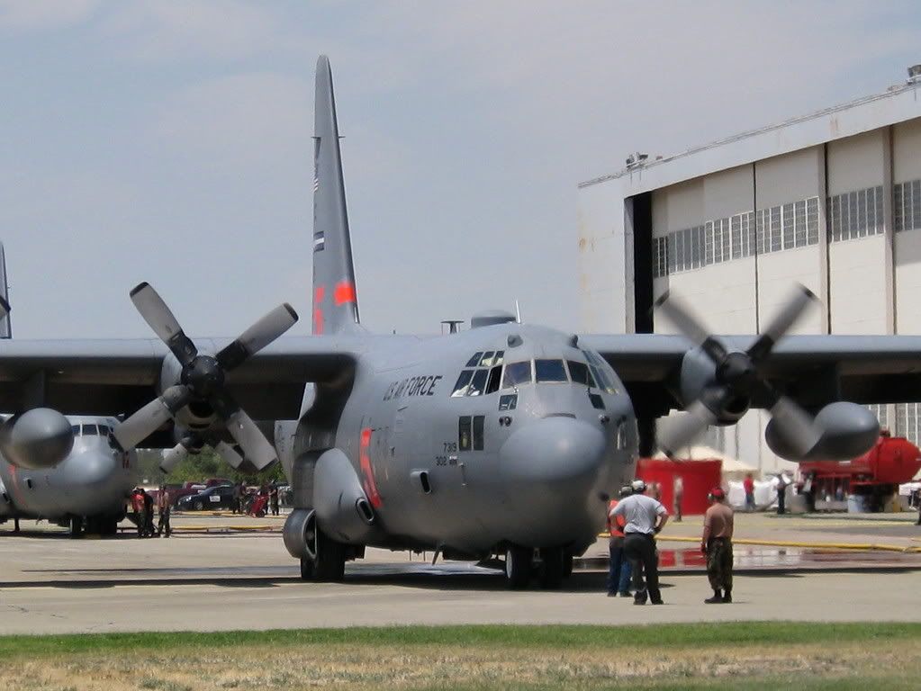
MAFFS at McClellan
McClellan has transformed into a very active airport - complete with temporary tower in operation again - with the arrival of 8 MAFFS. The C-130s have been coming and going constantly to the various fires surrounding the valley.
Short video of starting engines at: http://www.youtube.com/watch?v=yJuKHqcN8pk
and a FABULOUS video (not taken by me) of in-flight operations: http://www.youtube.com/watch?v=B_5rXdkN_R4
Short video of starting engines at: http://www.youtube.com/watch?v=yJuKHqcN8pk
and a FABULOUS video (not taken by me) of in-flight operations: http://www.youtube.com/watch?v=B_5rXdkN_R4
The Government Spring and Westville fires continue to ravage the North Fork American canyon. If you have Google Earth, use this link http://activefiremaps.fs.fed.us/kml/conus.kmz to load data points of active burning areas (it won't show the extent of the burned areas, but shows active fire areas).
Here's a view from Big Valley Bluff (last year) looking south. The spot I've taken the photo from is at the current eastern end of the Government Spring fire, looking across to where the eastern end of the Westville fire is now burning. It's a crying shame how much great country is getting burned. If there's anything good about it, at least it was not human-caused. The area will look quite different next year when I can ride out there - one of my favorite areas to visit.

Here's a view from Big Valley Bluff (last year) looking south. The spot I've taken the photo from is at the current eastern end of the Government Spring fire, looking across to where the eastern end of the Westville fire is now burning. It's a crying shame how much great country is getting burned. If there's anything good about it, at least it was not human-caused. The area will look quite different next year when I can ride out there - one of my favorite areas to visit.
Wherever I go, there I am
Paynes Creek 2016!
~~~~~~~~~~~~~~~~~~
16 Yamaha Wolverine R-Spec EPS SE
09 Yamaha Grizzly 700 FI 4x4 EPS
Paynes Creek 2016!
~~~~~~~~~~~~~~~~~~
16 Yamaha Wolverine R-Spec EPS SE
09 Yamaha Grizzly 700 FI 4x4 EPS
Who is online
Users browsing this forum: No registered users and 116 guests